i built a web app that lets you search real-world infrastructure using openstreetmap data.
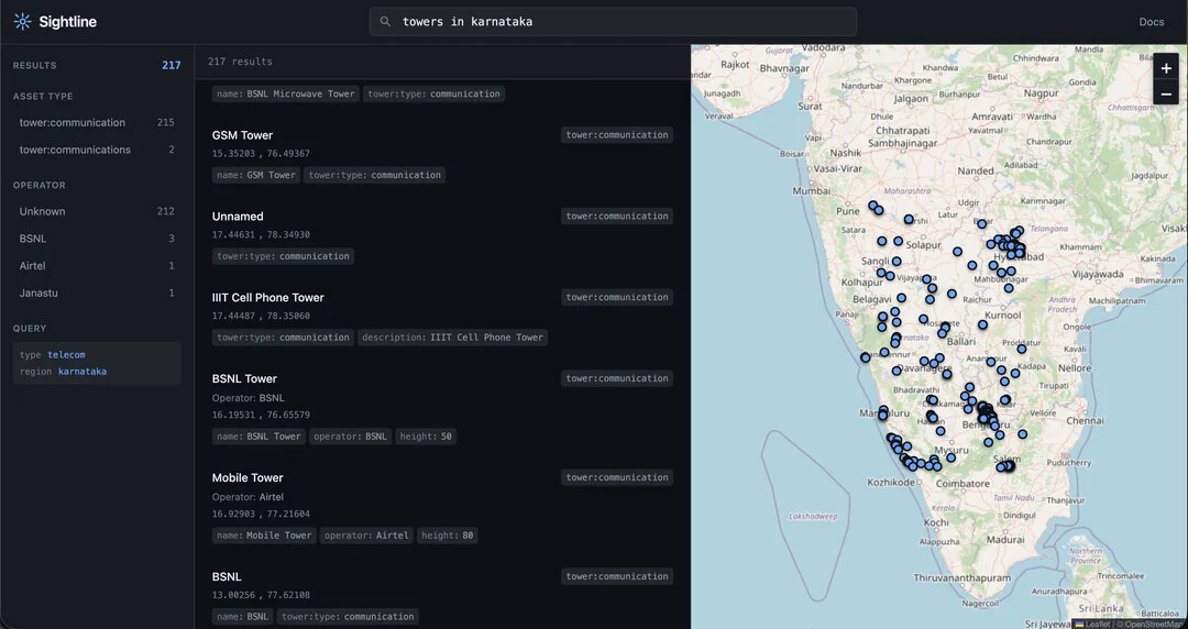
you can query things like data centers, power plants, dams, airports, military bases, hospitals, ports, telecom towers, pipelines, warehouses, etc, and see the results both as a list and on an interactive map. everything is powered by public osm data via nominatim + overpass, no private datasets or api keys.
it’s built with next.js (app router) + typescript, uses leaflet for maps, has basic nlp-style query parsing, filters, caching, and a simple api route for search. runs locally with npm install && npm run dev, and deploys cleanly on vercel. no env vars required.
main goal was to make infrastructure discovery easier without scraping or shady sources, just structured access to what’s already public, while respecting osm rate limits and usage policies.
would love feedback from people into osint, mapping, infra, or just frontend folks who enjoy map-heavy apps.
repo: https://github.com/ni5arga/sightline
try it out: https://sightline-maps.vercel.app